Category:Orienteering: Difference between revisions
From ScoutMedia, the free scout media repository
(New page: This category is for all media related to topography and orienteering. Category:Scoutcraft) |
mNo edit summary |
||
| Line 1: | Line 1: | ||
This category is for all media related to topography and orienteering. | This category is for all media related to topography and orienteering. | ||
[[Category: | [[Category:Technics]] | ||
Latest revision as of 17:36, 26 July 2008
This category is for all media related to topography and orienteering.
Media in category "Orienteering"
The following 27 files are in this category, out of 27 total.
 Azimut avec une boussole recta.jpg 2,592 × 1,944; 1.23 MB
 Cairn au dessus d'ovronnaz.jpg 1,024 × 760; 226 KB
 Carte et récepteur de radiogonimétrie.jpg 1,944 × 2,592; 1.71 MB
 Courbe niveau.svg 525 × 600; 15 KB
 Curvimetre.jpg 768 × 1,024; 143 KB
 Croquis pano.JPG 852 × 379; 72 KB
 Croquis topo.JPG 490 × 392; 52 KB
 Klippetang.png 941 × 531; 1.16 MB
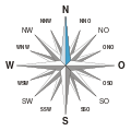 Kompass de N.svg 2,835 × 2,835; 6 KB
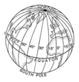
 Latitude (PSF).png 2,618 × 2,712; 537 KB
 Lille natcigar.png 1,167 × 753; 1.71 MB
 Longitude (PSF).png 2,437 × 2,532; 613 KB
 North with a watch.svg 592 × 481; 38 KB
 North with sun and stick.svg 1,187 × 1,050; 20 KB
 O-Ringen2.jpg 1,024 × 768; 268 KB
 Orienteering symbol.svg 500 × 500; 188 bytes
 Orj moa.jpg 600 × 800; 66 KB
 Post.png 800 × 600; 1.26 MB
 Silvatyp1.jpg 682 × 910; 151 KB
 Silvatyp1back.jpg 682 × 910; 132 KB
 Stor natcigar.png 1,127 × 622; 1.48 MB
 Stratum compass-clar hg.jpg 2,088 × 1,920; 275 KB
 Tajfuto.jpg 212 × 254; 25 KB
 Topographic map example.png 600 × 600; 152 KB
 Topographie boussole recta.jpg 2,592 × 1,944; 1.58 MB
 Wilimy.jpg 599 × 800; 584 KB
 Éclais en pleine chasse au renard.jpg 1,944 × 2,592; 1,011 KB


.png)

.png)